Digital Mapping in Chandigarh: Survey to start by the end of this month; every building’s record will be available in seconds.
Every building’s image and dimensions are now available on the Chandigarh administration’s server. For this goal, a computerised survey will soon begin. The National Geo-Spatial-Based Land Survey (NAKSHA) project is carrying out this survey under the Deputy Commissioner’s office.
By the end of this month, the work on this will start. A few Chandigarh localities and sectors have been chosen initially for this test project. The entire ਸ਼ਹਿਰ will then be mapped. For this work, the administration has engaged about 100 surveyors.
The State Project Management Unit (SPMU), a distinct organisation created for this purpose, has been given space in the Municipal Corporation building. Here, the skilled surveyors will receive training to complete the task. According to a worker who assisted in the surveyors’ training, the equipment has arrived, and work will shortly begin.

Digital assessment of building area
The purpose of this study is to collect comprehensive information on the number of buildings in the ਸ਼ਹਿਰ and their total area. Following this survey, each building will be given a digital number, and the administration will keep a digital record of every building.
In the past, this record was kept manually, and disagreements over land ownership or legal actions based on property registration frequently surfaced. Any property issues can now be settled using this information if the administration has access to the digital records.
Digital Analysis of These Domains The survey will first be carried out in the ਸ਼ਹਿਰ’s surrounding villages, including Sarangpur, Budail, Kajhedi, Palsora, and Attawa, as well as Sectors 2 through 17 (Sector 13 excluded). The remainder of the ਸ਼ਹਿਰ will then be surveyed. With a population of $147,945$, the project area for the first survey is $30.61$ square kilometres. For this, 20 teams have been established.

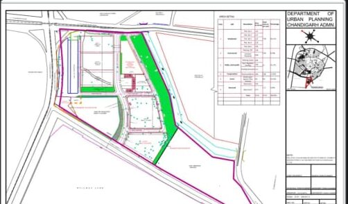
Problems with the Administration’s Manimajra Housing Project In the Municipal Corporation’s Manimajra Housing Project, a land issue is also starting to surface. The project was supposed to be constructed on 33.50 acres. However, it was discovered that there was less land actually accessible there a year after the work began. The issue of measuring this land has now emerged. Even though this project is supposed to be crucial to the ਸ਼ਹਿਰ’s development, the digital approach is now being employed to measure this acreage.
Four Points: The Need for the Digital Survey
1. The manual records of the ਸ਼ਹਿਰ’s buildings were difficult to maintain.
2. The evolution of the ਸ਼ਹਿਰ was not adequately documented.
3. Protracted court battles resulted from disagreements over the size of any ਸਰਕਾਰ or private building and the absence of documentation.
4. Officials from the Municipal Corporation won’t need to visit each property to accurately evaluate property taxes.